What Do You Know: Surveying at Endicott Rock
Winnipesaukee island monument commemorates 1652 expedition
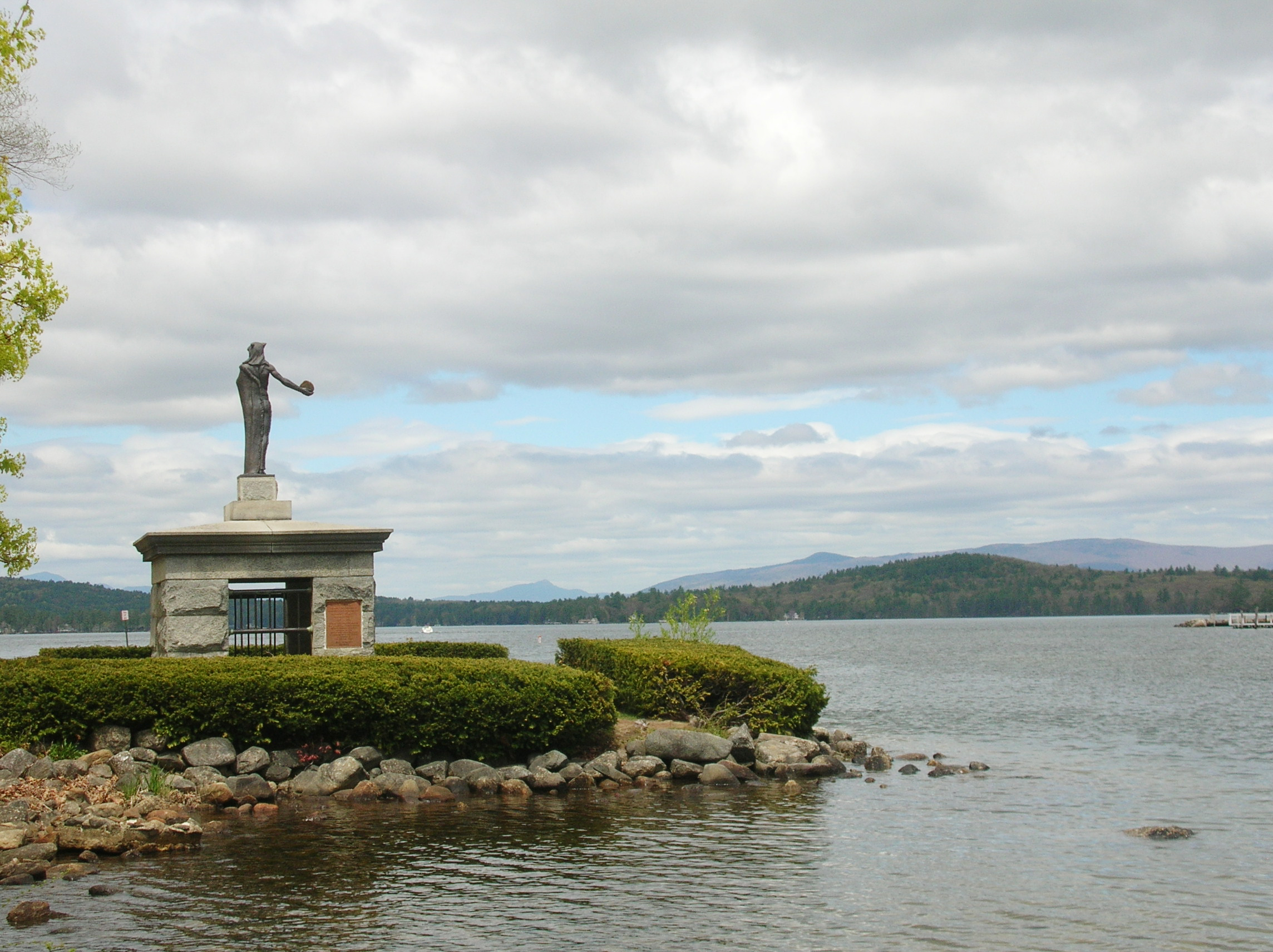
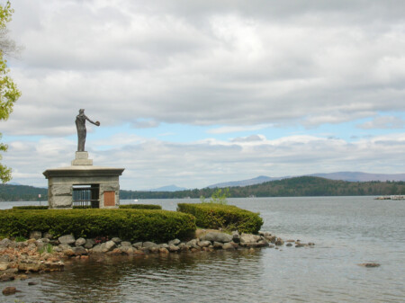
A statue of an Native American greets passing boaters from atop the granite enclosure protecting Endicott Rock.
I was surveying a property on one of Lake Winnipesaukee’s islands, so my crew and I were at the Lakeport dock at sunrise, busily transferring equipment from truck to boat.
Not knowing exactly what we might need and recognizing we would be on an island a long way from the truck, we exercised the “better to have and not need — than need and not have” school of thought and packed enough “just-in-case” equipment for an expedition.
Although not needed for the surveying project, I saw fishing poles and tackle find their way into the boat. Apparently, my crew anticipated doing some multitasking during their lunch break.
When the boat was loaded to the gills and ready to go, we shoved off and motored our way out of Opechee Bay, through Paugus Bay and headed north to the Weirs Channel. As we squeezed through the channel into Meredith Bay, we passed the Abenaki statue standing sentry-like atop the granite block cage protecting Endicott Rock.
I had some vague knowledge that Endicott Rock had something to do with an early surveying expedition to this location. So, feeling the irony of being in a boatload of surveyors on our own expedition up the lake … we detoured ashore to explore.
I learned that Endicott Rock is a monument to a 1652 surveying party thought to be the first white men in the area. The etchings they carved into the Rock were done to perpetuate the record of this official delegation sent by the Massachusetts Bay Colony to lay claim to the northernmost boundary of their disputed territory. These surveyors concluded that this spot was the head of the Merrimack River, and therefore the point called for in the land grant.
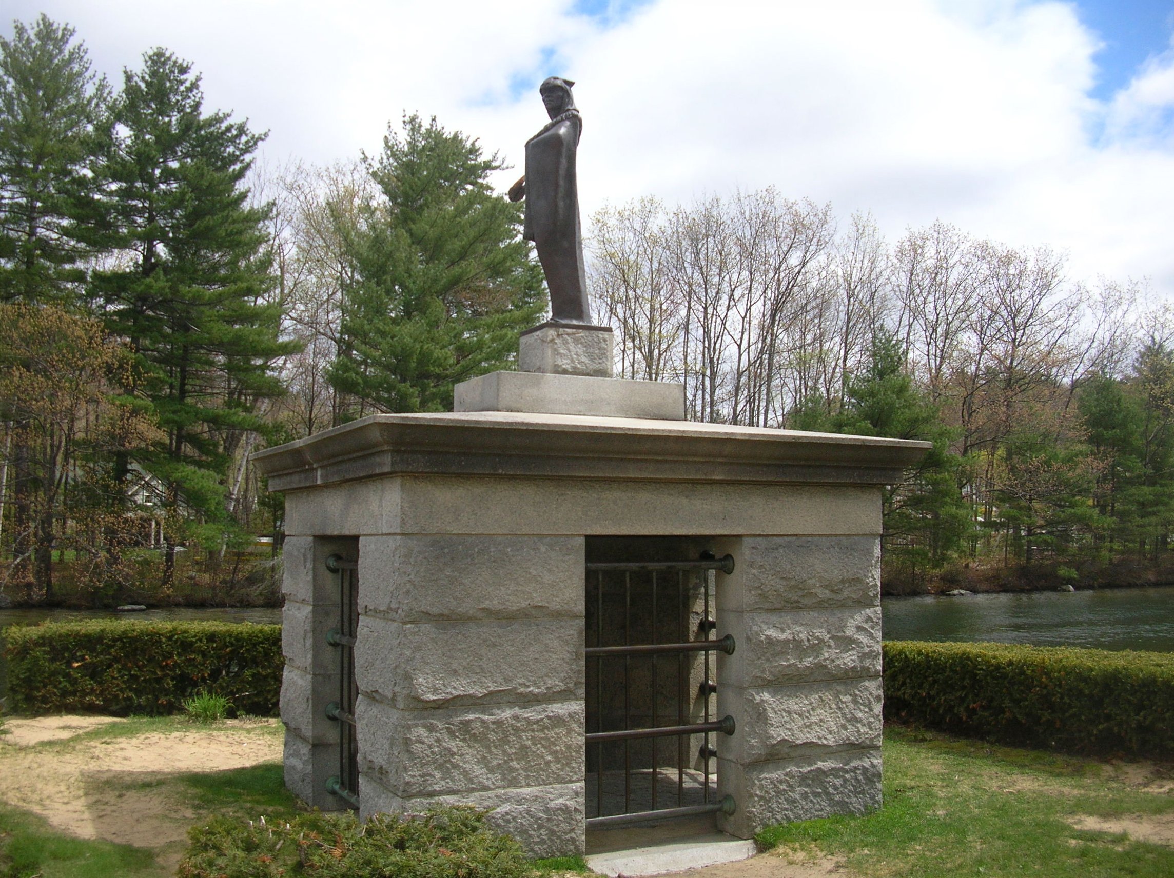
Endicott Rock, etched by surveyors in 1652, is inside this granite structure.
Capts. Edward Johnson and Simon (Symon) Willard were the leaders of this expedition and were assisted by surveyors John Sherman and Jonathan Ince along with a handful of other white men. Two Native American guides called Pontauhum and Ponbakin rounded out the crew.
Selecting this conveniently located, large, round-topped boulder at the mouth of the river channel, they chiseled into it the name John Endicott, governor of the Massachusetts Bay Colony, and the initials of Edward Johnson, Simon Willard, John Sherman and Jonathan Ince. They probably also chiseled in the date 1652, but time and weather have erased it.
The surveyors measured the latitude to be 43 degrees, 40 minutes, 12 seconds, “besides three miles more north wich runneth into the lake.” Fearing attack by indigenous people of the area, they didn’t stay long and quickly retreated downriver upon completion of their measurements.
Many years went by before other white people came to the area. Endicott Rock was almost entirely forgotten for some 181 years after the inscriptions were engraved. Then in 1833, it was rediscovered during a channel widening and dredging project.
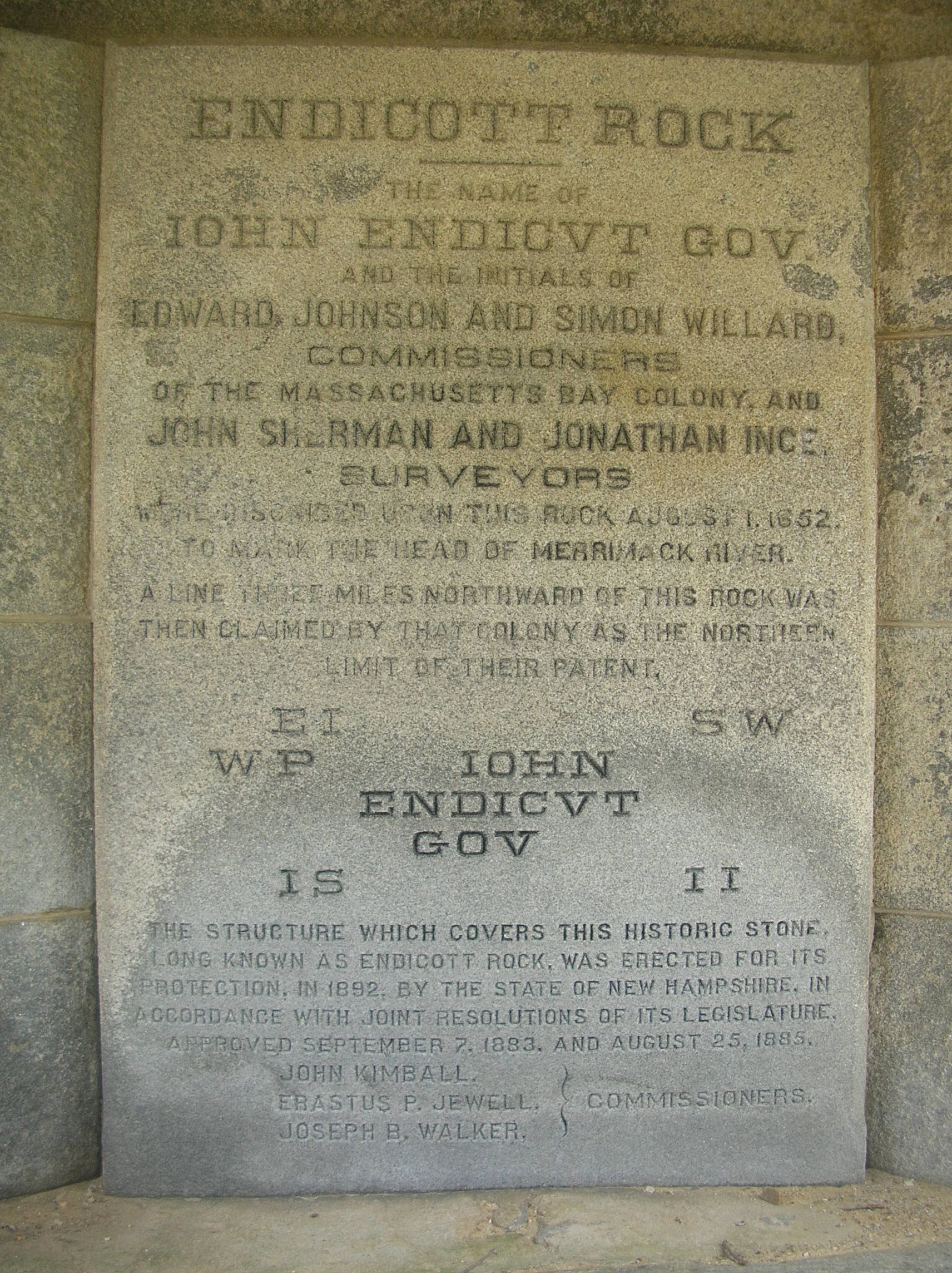
Above: An engraved panel located within the granite block enclosure.
The New Hampshire Legislature appropriated funds to raise the rock and make some effort to preserve it. In 1892 the state of New Hampshire completed construction of the present protective measures, including the memorial granite block structure encircling it with cage bars on the openings.
The rediscovered and now protected Endicott Rock was dedicated in the fall of 1892 at a ceremony with speeches by dignitaries. A speech excerpt reveals:
“In 1652 the Massachusetts Bay Colony resolved upon an exploring expedition, to determine and to fix the northern boundaries of their patents. Prior to this time conflicting views upon the construction of the peculiar description in their charter had been entertained, and now, upon a careful perusal of the instrument, it was determined that a point three miles northward of the head of the Merrimack river was the northern limit of their territory, and this notable expedition was organized to go up the river, to find the head thereof, and to establish the bounds …
“The men who came up the Merrimack 244 years ago did not penetrate the wilderness as adventurers. They were representatives of the Massachusetts Colony and came to determine boundaries and to take possession. The order of the court, May 3, 1652, was as follows: For the better discovery of the north line of our patent, it is ordered by this court that Captain Symon Willard and Captain Edward Johnson be appointed as commissioners to procure such artists and other assistance as they shall judge needed to go with them, to find out the most northerly part of Merrimack river, and that they be supplied with all manner of necessaries by the treasurer, fit for the journey, and they use their utmost skill and ability to make a true observation of the latitude of that place, and that they do it with all convenient speed and make return thereof to the next session
of this court.”
In 1901, a statue of a Native American donated by a local hotel owner was erected on top of the granite enclosure. This statue lacked historical accuracy of any tribe indigenous to the area, and wore a Seminole headdress while carrying a Mohawk tomahawk.
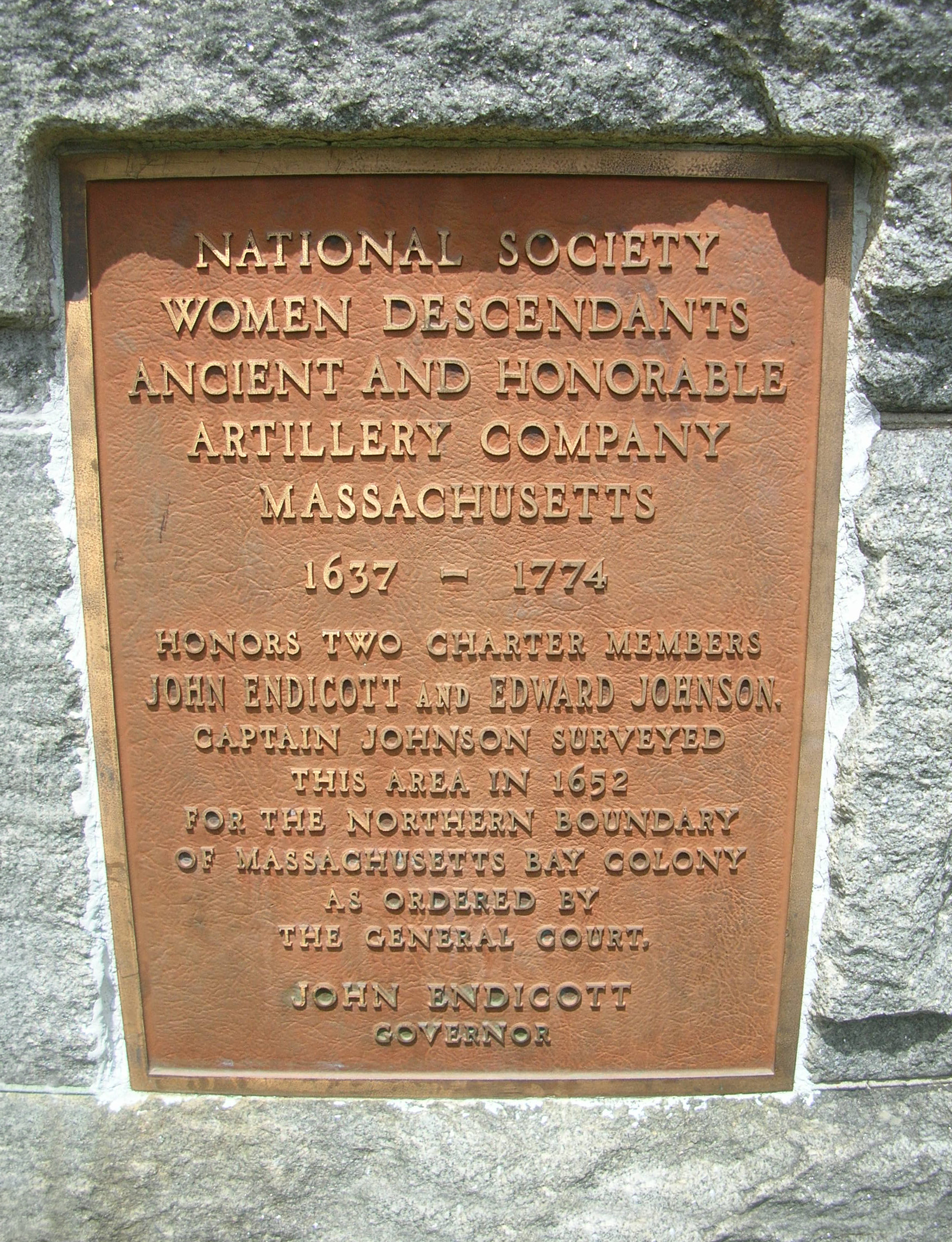
A panel mounted on the exterior. Both panels help tell the story of the survey party who landed here in 1652.
The statue was struck by lightning and damaged in 1978. After being repaired, it was relocated to a balcony overlooking the reading room at Laconia’s Gale Memorial Library, where it remains today. In 2004, sculptor Robert Morton was commissioned by the Weirs Action Committee to create a historically accurate statue of a Native American, as would have appeared to the explorers in 1652. Morton’s statue was dedicated on June 4, 2005, with participation of New Hampshire’s Native American Inter-Tribal Council.
I couldn’t help but compare my surveying project today with the surveyors who had come up the river some 370 years before me. We had likely followed the same route upriver and through the bays, but I’m guessing their motorless boat journey was a little more arduous than mine.
Their survey crew was larger in number, and they must have camped out each night, whereas we returned to comfortable homes. I suspect their boats were also loaded to the gills with, “have and not need vs need and not have” just-in-case equipment … but I’ll bet they too found room for some fishing tackle.