Paths to New Hampshire’s Native Past
Clues remain for those seeking New Hampshire's Native heritage
Move into an old home and a phrase comes to mind: “If these walls could speak.” Apply that same thought to the rugged hills and ragged shorelines of the Granite State, the “old home” in which we live, and it’s the rocks, the streams and the wooded trails that might share the stories of those who lived here before. Those elements were the boundaries and confines of the natives of this land who preceded us and lived here for millennia. Though they are mostly gone, whispers remain — but only if you know where to look and listen.
Walking back to a time when foot trails and rivers were the main drag and birch-bark canoes coursed the waters, imagine a shoreline scene of wigwams set aglow from home fires and a moonlit sky. Inside, a circle of people share stories and trade, eating fish and waving away woodsmoke — families coming together, celebrating the seasons and each other.
A recent National Geographic Channel special, “America Before Columbus,” notes that, in the 1400s, more people lived on our continent than in all of Europe and they had created “a managed landscape of cities, orchards, canals and causeways.” Likewise, New Hampshire’s Native roots cover every inch of the state, from the wooded realms of the north down to our big central lake and from our seacoast and salt marshes to the Connecticut River in the shadow of Mt. Monadnock. American Indians have lived here since the end of the last ice age, following food cycles, fresh water and fertile ground. The evidence that remains, mostly place names and myth, has become so familiar to us that we sometimes forget the source.
“It’s very important for people to understand that families were living in these places,” says Michael J. Caduto, author of “A Time Before New Hampshire: The Story of a Land and Native Peoples.”
“A lot of people think of Native history as being kind of static or represented by stone tools and bones and other archaeological findings,” he says. “Those artifacts are just evidence of the life that has been here for over 11,000 years — the Abenakis and all of their ancestors.”
To give an idea of the ubiquity and self-sufficiency of the Natives who once occupied this land, the name Abenaki or Alnôbak simply means “The People.” This common title encompasses all the different tribes that called the state home, such as the wide-ranging Pennacook or the Cocheco near the coast. Having survived plague, skirmishes, and centuries of colonization, the Abenaki culture continues today with traditions of dance, drum and language. Although there is no local reservation or population center for the descendants, their names endure as our handles for modern-day cities, mountains and rivers. But there are other links too. Paths back to that world still exist for those who seek knowledge of — and perhaps a brief communion with — the true “settlers” of this land, who planned and prepared, farmed and fought, lived and loved, worked and played, here in the place we now call New Hampshire.
The Great North Woods
In the North Country, beyond the notches, the paths pointing back include legends, crystal clear lakes and a mountainside mine of sacred stone. On Umbagog Lake, in Errol, there is an island that was the former home and namesake of an Abenaki known as Metallak. Reported to have lived to 120 years of age, he was known to be a gracious neighbor who would share his indigenous skills and knowledge — and stories of his exploits still survive today.
One legend tells of how he jumped on the back of a sleeping moose, then rode while being bucked and bashed up against pines and scrub brush, breaking ribs and tearing skin until he ended the ride with a well-placed knife blade. Another tells of how he sold the same piece of land twice to different buyers — an ironic act in the first place since Metallak didn’t believe in owning land. Metallak’s legacy is now cemented in a NH State Historical Highway Marker and a grave sign in Stewartstown that reads, “The lone Indian of the Magalloway, the last of the Coashaukes.”
Following the Androscoggin River out of Umbagog into Berlin, a short hike up Mt. Jasper will bring you to a mine carved out of the mountainside that holds a mineral with a special place in Native history. Rhyolite is a fine-grained, multicolored, glasslike stone that was a crucial resource for early people. Shaped into projectile points, knives and scrapers, the rock helped to supply the tools for survival.
“Mt. Jasper was very important to First Peoples,” says Abenaki artist Michael Eastman, who designed the interpretive signage for hikers on the mountain. “It was a destination to gather resources; it provided the material for people to survive. It was the Earth Mother helping to sustain life, just as we get water to quench our thirst and we get plants to provide nourishment. That rhyolite source provided the people with the material to sustain life, and for that reason it’s considered a sacred place to us.”

Mt. Jasper was sacred as a source of the glassy mineral rhyolite, which made excellent arrow and spear tips.
|
The White Mountains
Coming south and cutting through the White Mountains, you come to one of the most unspoiled scenic byways in the state heading east to Conway from the Lincoln-Woodstock interchange. The Kancamagus Highway is a roller coaster of postcard views and is named after a Pennacook chief who was the grandson of the famous Passaconaway, for whom Conway was named.
Passaconaway, or “Child of the Bear,” was a prominent leader who was present at the Pilgrims’ landing and who, like Metallak, was reported to have lived to 120. Passaconaway was also said to possess magical powers, such as bringing a dead leaf and a snakeskin back to life.
Following a succession of family leadership, Passaconaway was succeeded by his son Wonalancet and then by his grandson Kangamagus or “The Fearless One.” Kancamagus was unable to hold the peace his father and grandfather had made with the English and was driven into war, eventually moving north to Canada. Many Native people migrated to Saint-François-du-Lac in Quebec — where the Native settlement is known as Odanak — but the move did not mean the extinction of the Abenaki from New Hampshire. Some members of the tribe remained, hiding out in quiet places while the wars waged. After the civil war, many returned.
This region of New Hampshire — where most if not all the trails were first traversed by Native American feet — remembers Passaconaway’s famous family with three mountains and three villages.
The Trading Post at Intervale
A little north of Conway at the village of Intervale was the Abenaki Trading Post, a historic place Abenakis would go to in the summers to sell ash splint baskets, among other traditional crafts. Started by Chief Joseph Laurent in 1884, the Trading Post and seasonal camp were part of a movement back to ancestral lands and included traditionally built wigwams, a sweat lodge, five cabins, a totem pole and a gift shop. (The post wasn’t the family’s only claim to fame — Laurent also authored the first Abenaki-to-English dictionary, and his son Stephen continued with his father’s work, keeping their language and culture alive.)
While the Laurent family ran the trading post, though, they also were part of the Abenaki migration across today’s Canadian border. Many of the Laurents went up to Quebec while battles were waged in New Hampshire.
“It’s part of a story about how the Abenakis subsisted in the quiet backcountry of the northlands,” Caduto says. “Hiding out in the quiet places — in the deep forests, in areas around the wetlands — places non-native people didn’t tend to go very often. Abenaki families survived by living secretively in those places for many generations.”
When the Laurents returned to the trading post from their time in Quebec, things had changed. There was a new, friendlier kind of invader: tourists — and the trading post became an attraction. The intricate baskets sold at the trading post became a highly regarded product enjoyed by visitors for many years.
Today, the property where the trading post stood is jointly managed by the town and the descendants of the Laurent family. It is an open space, with a town park and interpretive signage, and Laurent family members still return to the site seasonally.

Stories of Native exploits echo through time, like the tale of how Metallak jumped on the back of a sleeping moose and took it for a rough ride.
|
Native Life on the Lakes
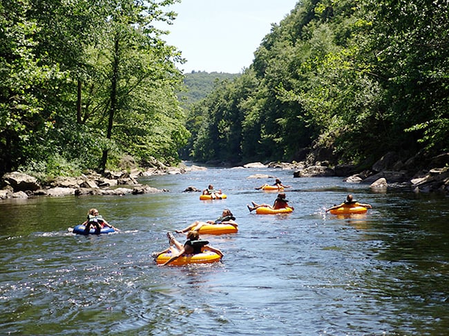
Weirs Beach and Lake Winnipesaukee have been hot spots to cool down as long as swimming and fishing have been in fashion — which, for bug-swatting summer lovers, is essentially forever. The Big Lake has always been a busy place, with great places for fishing. The Weirs (as it’s known to locals), situated at a channel between the lake and Paugus Bay, is named for the woven structures that Native Americans made out of stones and saplings to trap and harvest fish — all while meeting friends and catching up with family.
“Winnipesaukee and Weirs Beach is well-known as a major gathering place,” says State Archaeologist Dr. Richard Boisvert. “In the early historic period, there is one account of 200 canoes there.” They would catch fish and eat fish and socialize, not that different from today, Boisvert says, but he notes, “People have been going there … for at least 10,000 years.”
Spending any time poking into coves, exploring or fishing for salmon at this spot, you understand why it was such an amazing treasure to people, then and now. Today, a boardwalk there leads to the dock for the M/S Mt. Washington cruise ship. A tour of the lake on the Mt. Washington reveals the substantial size of the body of water in the heart of our state and is a reminder of how vast and sufficient this world must have seemed to the first people who inhabited it.
The Three Rivers City
From its southwestern edge at Weirs Beach through Paugus Bay and its neighboring lakes, the great Lake Winnipesaukee eventually connects to the 10.5-mile Winnipesaukee River. The waterway flows through the Lakes Region and into Franklin, where it meets two other rivers, the Merrimack and the Pemigewasset. The town where the three rivers converge was an ancient village and gathering spot long before the modern settlement was built. Though the Three Rivers City is currently in the midst of modern renaissance of sorts — a large-scale permaculture project and new hiking trails are among revitalization efforts — extensive evidence remains of its Abenaki heritage.
Among the massive pines at Odell Park off of Central Street, you can see the broad expanse of flat land that is framed by the river and you can almost hear the ancient thrum of the Native people living here, spending time with friends and extended family.
Uphill and east towards Laconia, the northwest corner of Central Street and Dearborn Street holds the Indian Mortar Lot, a state historic site and small park that contains a rare petroglyph of a shad, a common local fish, carved into a large boulder. Discovered by Frank Proctor in the 1920s along Meadow Brook, a tributary of the Winnipesaukee River in Franklin, the boulder was moved to the park for future preservation and study.
The historical marker sign also explains how the gouged glacial rock in the middle of this grassy spot was shaped first by water and then by the grinding of corn from both Native and settler hands, and how the carving of the shad, almost life-size, was pecked out of the granite rock by the Abenaki, who would have camped along the brook where the shad made their spring run.
Ossipee and Other Ancient Sites
Many of the communities where we live today — including Franklin, Laconia, Penacook/Concord, Hooksett, Suncook, Nashua and Manchester — were built on the sites of villages that Native people once occupied. Most of these places still provide the good fishing, hunting and workable ground that drew the Abenaki, and exploring these Native-founded towns can provide valuable clues into the lives of these earliest New Hampshirites.
Archeological work throughout the state has helped paint a better picture of who the Abenaki and their ancestors were, but Ossipee has proven particularly helpful in weaving together this evolving story.
“The Ossipee Village along the shores of Ossipee Lake was another substantial [Native] village well-known in historical times. The English even sent carpenters there to help build a fort to help protect [the Natives], so they could trade with them. The area is rich in archeological sites and has its own village and tribal name — and that was a great place to be,” says Boisvert.
“There’s an expectation that people have that pre-contact Native American sites are burial mounds or pueblos. We don’t have those obvious, flashy sites here in NH,” says Boisvert. “By and large, if you go somewhere in NH and it looks really nice and you’d like to live there, you’re not the first one to have that idea.”

The Abenaki took advantage of the abundant resources of the seacoast area, even taking dugouts to sea to spear seals and small whales.
|
The Seacoast
Somersworth, Dover, Great Bay and Hampton were all sites of ancient villages. These coastal communities we know and enjoy today were shaped by their resources. In fact, the fishing trade is what attracted the first Europeans to explore and create outposts here, so it’s not surprising that the original residents were avid fishermen as well.
“Among the most eye-opening things were the large, impressive dugout canoes that hunters used to go out on the ocean in pursuit of fish and marine mammals,” says Caduto. “Today, very few people realize that native people from coastal New England once used harpoons to fish for cod, swordfish and tuna and to hunt seals, porpoises and small whales.” Caduto describes how hunters from one coastal village in New Hampshire’s Great Bay used harpoons tipped with bone fashioned into long, lance-like tips, barbed along one edge.
When the abundant fish stocks eventually drew European settlers to the area, it signaled the beginning of the end for the local Natives. The resulting post-contact history of the coast is riddled with reports of raids, captures, treaties and decimating disease. Four hundred years ago, from 1616 to 1618, newcomers arrived with their unfamiliar germs that devastated whole communities, as the Native population had no natural immunities to fight this foreign scourge.
The Capital Region
The Pennacook inhabited the land that’s now Concord as well as regions beyond. The group had three main villages on the bend in the Merrimack River where our capital city now stands, and their turf fanned out in all four directions, from Sunapee to Winnipesaukee and south to Massachusetts. In the fertile land stretching from the Concord Heights to Fort Eddy Plaza and up and down the Merrimack River, the Pennacook would plant staple crops such as corn, beans, squash and pumpkins, while awaiting fish runs that would take them to Manchester’s Amoskeag Falls and others for spawning season.
“At the place that we now call Sugar Ball Bluff, in the vicinity of Concord, there was a very large Abenaki presence long before people from Europe invaded the region,” says Caduto. “It was an expansive community —several interconnected villages of up to 500 people whose gardens stretched along the river for a couple of miles. Passaconaway lived in the village at Sugar Ball Bluff in the 1600s; descriptions of him and his accomplishments are prolific in the historical accounts.”
The two other main villages were at Sewalls Falls and where Fort Eddy Plaza sits today. The homeland for these people was known as Gedakina, meaning “Our Land,” and was kept in careful check by a belief system that saw a spirit in all living things. This intimate relationship with the natural world was one of balance, reminding them to harvest only what they needed and to work in cooperation with the land and its seasons.
“One of the most compelling things that I’ve learned in all of the years that I have worked with and taught about New Hampshire’s Native peoples,” Caduto says, “is that Abenaki life has always been heavily influenced by their relationship to their environment, and vice versa — how both culture and environment impacted each other and mutually formed the direction that each evolved over time.”

It was much quieter than Laconia’s Motorcycle Week when Natives would gather by the hundreds at the area now called The Weirs, but a festive spirit reigned.
|
Amoskeag in Manchester
Amoskeag, meaning “place of many fish” or “good fishing place,” was an important springtime stop on the Abenaki annual calendar. With naturally occurring falls and pools, the spawning season at Amoskeag each year brought people from the Lakes Region and points north to a wide swath of the Merrimack Watershed that flows south into Massachusetts to gather fish, to celebrate the bounty of the season, to trade, and to keep social circles connected.
“Amoskeag is the best-known [Native] fishing site in the state and arguably the best known in New England,” says Boisvert. On the site of today’s Amoskeag Bridge, two swaths of land provide unparalleled glimpses into the history of this prosperous locale.
The Neville site, following the slope that goes down to the river beneath the Amoskeag Bridge, “has a very long occupation span,” says Boisvert — at least 8,000 years, and possibly longer. The Smyth site, named for 19th-century New Hampshire governor Frederick Smyth, sat essentially on the location of today’s Brady Sullivan building. This was a major population area in Abenaki days, and the construction of the Amoskeag Bridge in the 1970s revealed a wealth of Native history including one of the oldest pieces of pottery in the Northeast. Finds from these sites range from pottery to stone tools and can be viewed at the Manchester Historic Association’s Millyard Museum.
Abenaki Now
As seen in the people and places of our past and our present, New Hampshire is home to a Native heritage that has endured for more than 11,000 years. It is an evolving history that continues today in a culture that celebrates tradition and custom in an ongoing and unbroken circle.
The culture continues in powwows held around the state and region and in meticulous reenactments at spots like the Fort at No. 4 in Charlestown, where the era of the French and Indian War is preserved. A few statues, such as the Endicott Rock monument on Lake Winnipesaukee, honor the previous tenants of the land. Arrow and spearheads can still be found in the soil of our state, particularly in spots like Ossipee, where the population of Natives was large and active.
Native American storyteller Carolyn Black Hunt of Littleton says one of her favorite reminders of our state’s First People is the presence of “trail trees” along the Mt. Pemigewasset Trail in Franconia. Long ago, Natives would bend young hardwood trees horizontally and stake them, Hunt explains, then allow the tops to grow straight up from the bend, over time creating a durable sign that could even be seen in deep snow. Trail trees were used to point toward good fishing spots, best places to ford stream or safe spots to camp. “There were probably trail trees all over,” she says, “before the logging barons came and stripped the timber from the land.”
“For most Indian people, our prime concern is for the Earth itself,” says Michael Eastman. “Because anybody with any common sense at all would understand and realize that all the medicines we ever need are right under our feet and anything that we need to sustain ourselves is also right there.”
The rugged landscape of our state has always had an allure to the people who call these woods and waters home, in spite of terrain too tough to traverse and soil that yields an annual crop of roots and rocks soon after the plow has past. It can be a hard life and there are many lessons that we, the new residents of the house we call New Hampshire, are still learning. Fortunately, for those who know where to look and how to listen, some wise whispers from the past can still be heard.
Finding Today’s Paths Through Ancient Lands
Many facts and anecdotes in this story were borrowed from Michael Caduto’s scholarly but very readable book “A Time Before New Hampshire.” The map below is an edited version of one of the four interpretive signs that Native American artist Michael Eastman created for the trails of Mt. Jasper.
 |